Part of an 1895 World atlas showing
Venedocia village and surrounding counties in Ohio and Indiana.
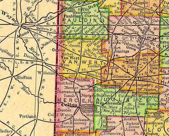 You are looking at part of the Ohio page scanned from an 1895 atlas
published by Rand McNally entitled "The New 11x14 Atlas of the
World". Venedocia can be seen near the lower right corner of yellow colored Van Wert
County. Although the village was at that time still not
incorporated, the atlas lists Venedocia's population as 284.
Railroads and rivers, not vehicle roads, are what are what most of the lines on
the map show. The railroad shown going through Venedocia was then called
the Toledo St. Louis and Kansas City Railway. The tracks were removed June 1998. All that is left of this railroad is the very short part between Landeck and Delphos.
You are looking at part of the Ohio page scanned from an 1895 atlas
published by Rand McNally entitled "The New 11x14 Atlas of the
World". Venedocia can be seen near the lower right corner of yellow colored Van Wert
County. Although the village was at that time still not
incorporated, the atlas lists Venedocia's population as 284.
Railroads and rivers, not vehicle roads, are what are what most of the lines on
the map show. The railroad shown going through Venedocia was then called
the Toledo St. Louis and Kansas City Railway. The tracks were removed June 1998. All that is left of this railroad is the very short part between Landeck and Delphos.
This map was taken from the
Livingston County MI U.S. GenWeb Project web site. Almost
the entire U.S. part
of the 1895 atlas can be downloaded from this site!
Return to Venedocia Home Page
Back to Venedocia ancient map index page