Maps of the Venedocia Ohio Area
-
-
USGS topographic map of Venedocia
-
- Topographic map of Van Wert
County showing groundwater resources
-
-
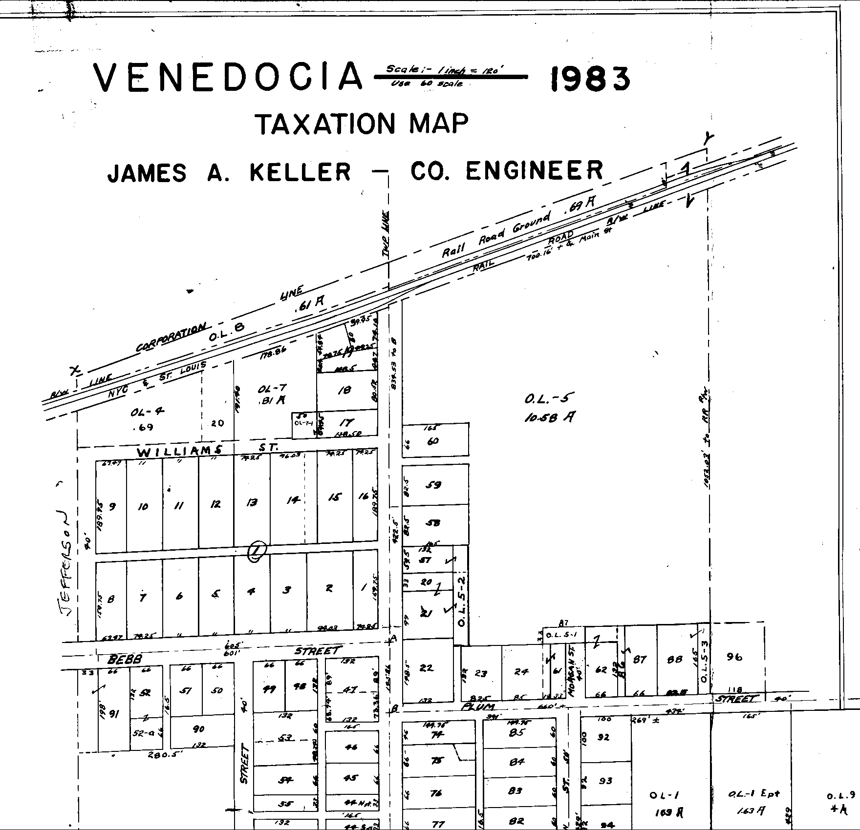
1983 tax map of the north half of Venedocia (826k file). This map shows in great detail the size of lots in the village.
To return to this page click the "Back" button of your browser.
-
-
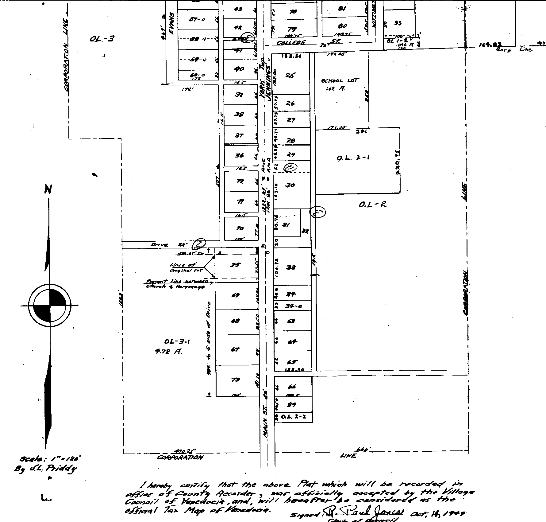
1983 tax map of the south half of Venedocia (669k file). This map shows in great detail the size of lots in the village. To return to this
page click the "Back" button on your browser.
-
-
Jennings Township near the
village. From the 1996 tax map. Click your browser's "Back" button to return to this
page.
-
-
York township near the village. From the 1996 tax map. Click
your browser's "Back" button to return to this page.
-
-
2010 Boundary and annexation map showing village street names and nearby stream and river names.
-
-
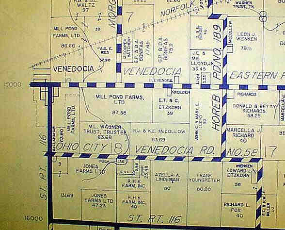
This is a map of the countryside near the village.
-
-
This is a larger scale map
of northwest Ohio showing the location of Venedocia with respect to
other towns and villages in the area.
Some maps on this page used with permission of
Map Quest.
Visit their site and create your own custom maps of anywhere in the
United States, for free!
Return to Venedocia Home Page